Agriculture APPLICATIONS
Crop monitoring
A professional drone, such as the multispectral eBee SQ agriculture drone, provides a holistic view of a crop’s growth, enabling agricultural professionals to quickly and precisely identify issues, and better target their field scouting. Multi-year drone data also allows the better planning and monitoring of improvements, such as ditches and evolving fertilizer applications.
Soil assessment
Drone data can be employed to extract soil characteristics. These include temperature, moisture, slope, elevation and more. This ability enables more accurate soil sampling and the production of more suitable seeding prescriptions.
Plant emergence & population
Professionals like agronomists are increasingly using the data from agricultural drones to better understand which plants emerge, as well as population and spacing metrics. This information is then used to drive replanting decisions, thinning and pruning activity, and to improve crop models.
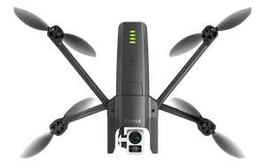
Durable EagleNXT drone technology adds value throughout the growing season, from monitoring plant emergence right through to pre-harvest yield prediction and drainage planning for the next season.
With a drone an agriculture professional can capture highly accurate images of a farm’s fields, covering up to hundreds of hectares/acres in a single flight—without the cost and hassle of manned services and at a far greater resolution than satellite imagery provides, even when there is cloud cover.
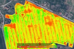
By using powerful image processing software operators can then easily transform these shots into one large ‘orthomosaic’ image. Then simply apply algorithms such as the Normalized Difference Vegetation Index (NDVI) to this image to create a map of the reflected crop. This map is the key to boosting yields and cutting costs, since it highlights exactly which areas of crop need closer examination— meaning less time spent scouting, and more time treating the plants that need it.
Related Agriculture PRODUCTS
-
Pix4Dfields
Read moreCreate accurate field maps, generate insights and analyze field data in real time to increase crop productivity

REQUEST A QUOTE
WHAT OUR CLIENTS SAY
We are absolutely loving the [eBee SQ] unit so far. It is user friendly and has many features that were not available on UAVs that we have used in the past. We can quickly create missions and get it in the air, and most importantly for us, it is able to map thousands of acres per day. I can’t say enough about the support [...]. Not only are they always available to answer questions, they even came across the country to give us a personal training session for our newly purchased eBee.
Daniel Carr - G & C Imaging Solutions 


