


Drones
-
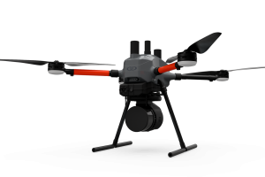
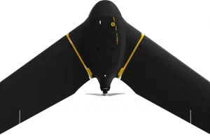
EasyOneLiDARUHR+
$0.00 Add to cartThis is our best LiDAR drone surveying equipment ever. Built upon our 4th-gen drone technology, all EasyOne systems are more compact, more optimized, lighter, safer and more efficient. This system delivers integration unmatched in the drone surveying industry, making it easier than ever for you to plan, fly, collect, process and visualize your geospatial data projects.
-
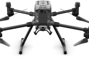
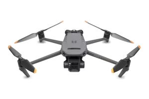
Matrice 300 RTK
$8,950.00 Add to cart15 km Max Transmission
55-min Max Flight Time
IP45 Rating
Smart Inspection
Smart Pin & Track
Primary Flight Display -
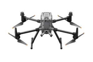
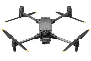
Matrice 350 RTK
$10,939.00 Add to cart20 km DJI O3 Enterprise Transmission
55-min Max Flight Time
IP55 Rating
6-Directional Sensing & Positioning
DJI RC Plus
Primary Flight Display
Night-Vision FPV Camera -
-
-
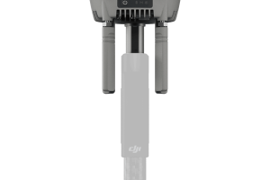
D-RTK 3 Multifunctional Station
$2,205.00 Add to cart- Centimeter-Level Positioning
- Multi-Mode Functionality (Broadcast, Relay, Rover)
- Supports Major GNSS Systems
- Seamless Integration with DJI Software
- IP67 Weather-Resistant Design
-
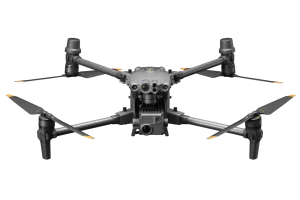
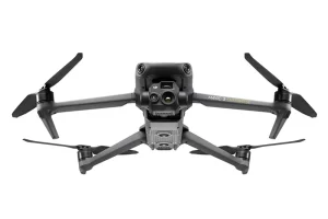
DJI Matrice 30
$8,649.00 Add to cart- 48MP 1/2″ CMOS Sensor Camera
- Laser Range Finder 3-1,200 m
- 41min Flight Time
- 15m/s Wind Resistance
-
DJI Matrice 4E
$6,229.00 Add to cart- 48MP 4/3″ CMOS Sensor Camera
- Laser Range Finder 3-1,800 m
- 49min Flight Time
- 12m/s Wind Resistance
-
DJI Matrice 30T Thermal
$12,039.00 Add to cart- 48MP 1/2″ CMOS Sensor Camera
- Infrared Image Super-resolution Mode: 1280×1024
Normal Mode: 640×512 Thermal Camera - Laser Range Finder 3-1,200 m
- 41min Flight Time
- 15m/s Wind Resistance
-
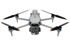
DJI Mavic M3E Enterprise
$4,490.00 Add to cart- 45min flight time
- 56x Hybrid Zoom
- 20MP 4/3cmos Sensor Camera
- DJI O3 Enterprise Transmission
-
DJI Mavic M3T Thermal Enterprise
$6,880.00 Add to cart- -20° to 150° C (-4° to 302° F, High Gain Mode)
0° to 500° C (32° to 932° F, Low Gain Mode) - 640×512@30fps
- 45min Flight Time
- 32km Flight Distance
- -20° to 150° C (-4° to 302° F, High Gain Mode)
-
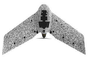
eBee TAC Government
Read more- 1.5 cm / 0.6 in mapping accuracy
- 90 minutes flight time
- 500 ha / 1,235 ac in a single flight
- 1.6 kg / 3.6 lbs