EasyOneLiDARUHR+ – CartoCanada
Canada’s only authorized distributor
for AgEagle and Parrot drones.

EasyOneLiDARUHR+

This is our best LiDAR drone surveying equipment ever. Built upon our 4th-gen drone technology, all EasyOne systems are more compact, more optimized, lighter, safer and more efficient. This system delivers integration unmatched in the drone surveying industry, making it easier than ever for you to plan, fly, collect, process and visualize your geospatial data projects.

Category Tags ,

SHARE THIS PRODUCT ON:

Industrial Drone Line

This is our best LiDAR drone surveying equipment ever. Built upon our 4th-gen drone technology, all EasyOne systems are more compact, more optimized, lighter, safer and more efficient. This system delivers integration unmatched in the drone surveying industry, making it easier than ever for you to plan, fly, collect, process and visualize your geospatial data projects.

EASYONE IS EASIER TO TRANSPORT

EasyOne features a significantly smaller operational form factor with the same payload capacity of the md4-1000 platform. In addition to a smaller operational form factor, the EasyOne packs down even smaller, fitting the drone, remote, charger, two batteries and the payload into a protective storage case that’s small and light enough to bring anywhere.


PICTURED LEFT: GONE ARE THE DAYS OF NEEDING A LARGER VEHICLE TO TRANSPORT YOUR DRONE SURVEYING EQUIPMENT. THE EASYONE DRONE PACKS DOWN INTO A PROTECTIVE CASE THAT IS 31.69” X 15.94” X 15.75” (805 MM X 405 MM X 400 MM)

EASYONE IS ALL IN ONE.

The improved controller is completely integrated with mdCockpit. No more connecting a tablet to your remote!

NEW! First person view in flight video display

  • EasyOne features an entirely new controller design that provides an enhanced user interface and powerful safety features, such as Real Time Terrain Follow.
  • Combined device and integrated remote control- the RC and display are one integrated control unit.

mdCockpit is integrated directly on your RC screen!

  • FPV available directly on the remote
  • Ask us about NDAA compliant version.
  • High level command of the drone without using the sticks on the remote

LESS IS MORE: The new EasyOne drone platform is smaller than competitive drones able to carry survey grade LiDAR equipment. It’s easy to pack in a small vehicle, easy to carry in the field and easy to use on every project.

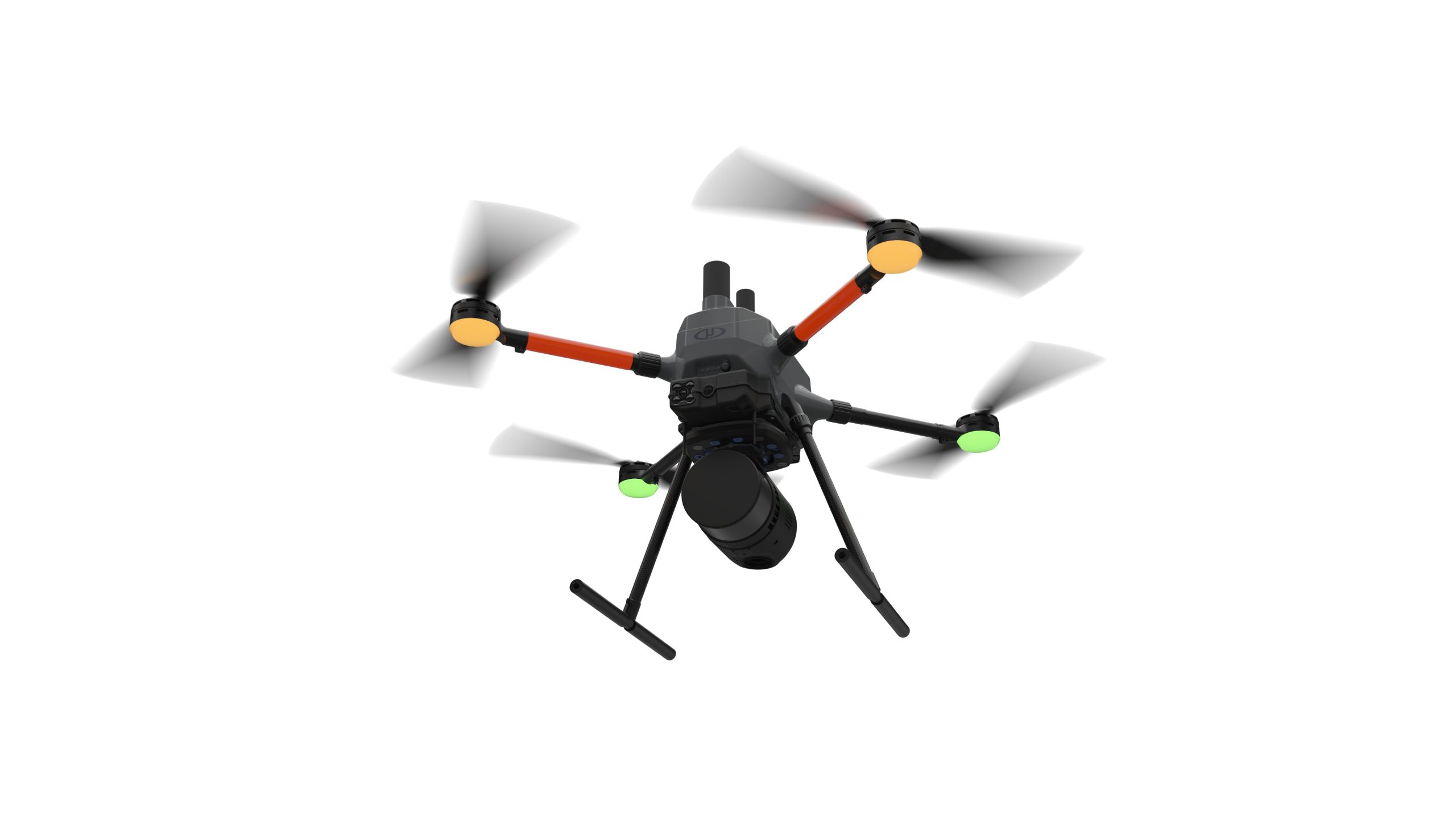
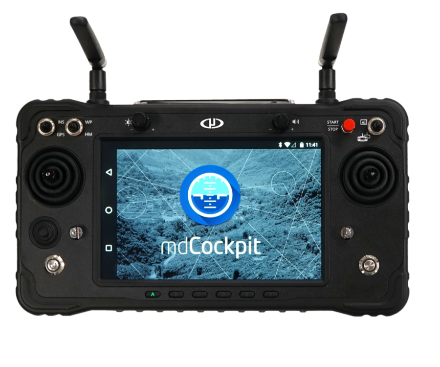
"This is a new beginning for the Microdrones aircraft platform. It fits in a case that’s less than a foot and a half wide. The mdCockpit mission planning screen is fully integrated into the RC. All sensitive onboard electronics are designed, manufactured and assembled in the USA and Germany. All this, yet it's just as powerful as our legacy drone platform."
Frank Darmayan
CTO

NEW FEATURES FOR BIG SAFETY & PRODUCTIVITY BENEFITS

A NEW BATTERY MANAGEMENT SYSTEM FOR SMART SURVEY AND GEOSPATIAL PROS:


EasyOne includes a new Battery Management System that enables easy charging. Via a single connector, plug it in, and charging starts automatically if required.

Throughout battery maintenance and charging, the battery state is indicated via LEDs on the battery.

"The EasyOne checks all the boxes that our customers have asked for when it comes to a versatile and more compact drone surveying system. The LiDAR sensor provides very dense, point-rich data, with highly effective vegetation penetration. The set-up was straightforward, especially with the new payload quick-connect feature. Plus, the size alone makes it much more convenient for transport, especially when you’re working in isolated areas. It even fits under the tonneau cover in the back of my truck."
Brady Reisch
Virtual Design and Construction Reality Capture Specialist, Kuker-Ranken

EASYONE AIRCRAFT PLATFORM SPECS:

Size

  • circle with 70 cm diameter to include all motor nacelles
  • 495 mm x 495 mm from nacelle to nacelle
  • 955 mm x 955 mm rotor tip to tip
  • 454 mm height to top of the antenna

Flight time (estimated)

app. 40 min with UHR payload at our location (app. 300 m ASL)

Packaged weight

5500 g

Platform
2000 g

Battery
2100 g

Payload
1400 g

Max take off mass
5700 g

EasyOneUHR+ TECHNICAL SPECS

SOLUTION COMPONENTS

Platform
EasyOne

Payload

  • LiDAR Sensor: Hesai Pandar XT32M2X
  • Camera Sensor: 1x Microdrones CMOS APS-C 26 MP
  • Georeferencing: Trimble APX-15 UAV

Software

  • mdCockpit
  • LP360 Drone
TECHNICAL SPECIFICATIONS

Takeoff Weight (TOW)

5.2 kg

System Operation Temperature

-10 °C to 40 °C
14 °F to 104 °F

Scanner Performance

  • Precision: 5 mm
  • Accuracy: 20 mm
  • Number of returns: 3

GNSS/INS Performance

  • Position 20-50 mm
  • Angle: 0.025 deg Roll/Pitch, 0.08 deg Heading

System Performance

  • Precision observed on one strip: Typical 20 mm, Less than 15 mm (1 sigma) observed at 75 m on concrete
  • Accuracy: Typical 3 cm RMSE, better than 5 cm 3D RMSE – depending on GNSS conditions, accuracy of control points and coordinate system

Photogrammetry

  • Horizontal: 2 – 3 pixels
  • Vertical: 3 – 5 pixels

Request a quote