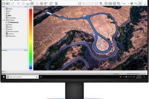
Drone Software Archive – CartoCanada
Canada’s only authorized distributor
for AgEagle and Parrot drones.

Drone Software

Now surveyors in Canada have something to get excited about: CartoCanada is proud to offer excellent drone software for survey purposes. With this technology, surveyors are able to not only access complicated terrain with ease, but also create 3D modelling accurate maps and GIS features. All of this provides better precision and accuracy of data than what can be achieved using traditional survey techniques. Whether the survey is big or small, CartoCanada’s software will ensure survey takes off with highly accurate results.

Drone Software

  • Pix4Dmapper

    Pix4Dmapper

    Define an area of interest, select processing options, add ground control points or edit point clouds, DSMs, meshes, and orthomosaics.
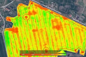
    Read more
  • Pix4Dfields

    Pix4Dfields

    Create accurate field maps, generate insights and analyze field data in real time to increase crop productivity
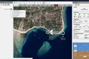
    Read more
  • Pix4Dcloud

    Pix4Dcloud

    Get an instant view of any jobsite from anywhere, on your browser, in 2D and 3D, with results you can measure, explore, compare, share and collaborate on.
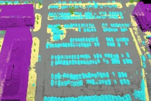
    Read more
  • Pix4Dmatic

    Pix4Dmatic

    Pix4Dmatic is designed to work with the latest generation of drones for professional applications and transforms your large number of images into accurate point clouds, DSMs and orthomosaics.

    Read more
  • eMotion

    eMotion

    eMotion is the only professional-grade drone software to support both fixed-wing and multirotor operations.

    Read more
  • CORRELATOR 3D TM SOFTWARE

    CORRELATOR3DTM SOFTWARE

    Fast processing on GPUs and multi-core CPUs.

    Read more