eBee X AgEagle Drone – CartoCanada

eBee X

Absolute Accuracy up to 1.5 cm/0.6 in.
Flight time up to 90 min.
Takeoff weight 1.6 kg
Up to seven sensors and cameras compatible
Optimized cameras up to 500 ha/1,235 ac.

SKU 10 Category

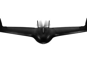
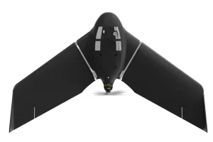
The eBee X is the fixed-wing drone for all your mapping needs. Designed to boost the quality, efficiency and safety of your data collection, it has a camera to suit every job, the accuracy and coverage to meet every project’s requirements, and can work virtually every type of site.

Product

FEATURES

EFFICIENT & PRECISE

The eBee X can meet the exacting requirements of every project. Its unique Endurance Extension unlocks a maximum flight time of 90 min—for vast coverage of up to 500 ha (1,235 ac) at 400 ft*—while its High- Precision on Demand helps you achieve absolute accuracy of down to 3 cm (1.2 in), without GCPs.

RUGGED & RELIABLE

The eBee X allows you to work virtually every site, no matter how demanding, thanks to its space-friendly Steep Landing technology, ultra-robust design, live air traffic data and more.

MULTI-PURPOSE

The eBee X suits every job thanks to its range of groundbreaking cameras. These include the new AgEagle S.O.D.A. 3D, for stunning 3D reconstructions of vertical environments, the best-in-class AgEagle Aeria X RGB photogrammetry camera and the AgEagle Duet T for creating geo-accurate thermal maps.

Always On Worry-free Drone Service

Providing professional drone operators with true peace of mind. Because business never stops.

FIND THE RIGHT SOLUTION

Contact one of our solutions specialists to explore the drones, sensors and software
options that will work best for you.