Process any field imagery locally or in the cloud, with the new instant processing agriculture software and get your farm maps 10x faster.
ANALYZE
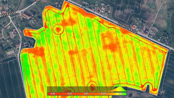
Visualize and understand your crop growth stages and stress levels.
Analyze and compare different layers of information for a full insight of your yield performance and use them to increase crop production and reduce costs.
INTEGRATE
Download all outputs, results and insights and import them into the Farming Management Software of your choice in various industry standard formats.
Create accurate field maps, generate insights and analyze field data in real time to increase crop productivity
FIND THE RIGHT SOLUTION
Contact one of our solutions specialists to explore the drones, sensors and software options that will work best for you.