Survey-Grade Accuracy on Demand
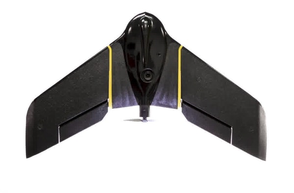
eBee Plus
The eBee Plus survey drone is a large-coverage photogrammetric mapping system featuring RTK/PPK upgradeability, for survey-grade accuracy on demand.
Product
FEATURES
EFFICIENT
The eBee Plus can map a larger area, per flight, than any drone in its weight class, so you can maximise your efficiency & plan projects with confidence.
ACCURATE
The eBee Plus survey drone includes High-Precision on Demand; built-in RTK/PPK functionality to activate out of the box or when required. It‘s survey-grade accuracy you control, without the need for ground control points.
FLEXIBLE
The eBee Plus offers a camera to suit virtually every geospatial application: the EagleNXT S.O.D.A. (supplied) for photogrammetric drone mapping, plus thermal infra-red & multispectral options.
Always On Worry-free Drone Service
Providing professional drone operators with true peace of mind. Because business never stops.
FIND THE RIGHT SOLUTION
Contact one of our solutions specialists to explore the drones, sensors and software
options that will work best for you.


