Canada’s only authorized distributor
for AgEagle and Parrot drones.
for AgEagle and Parrot drones.
Canada’s only authorized distributor for EagleNXT drones.
FARO® Orbis™ is a unique mobile scanning solution created to optimize workflows and elevate productivity.
SHARE THIS PRODUCT ON:

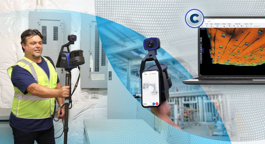
Mobile and Stationary Technology in One Device Thanks to Hybrid Reality Capture™, Powered by GeoSLAM and Flash Technology™
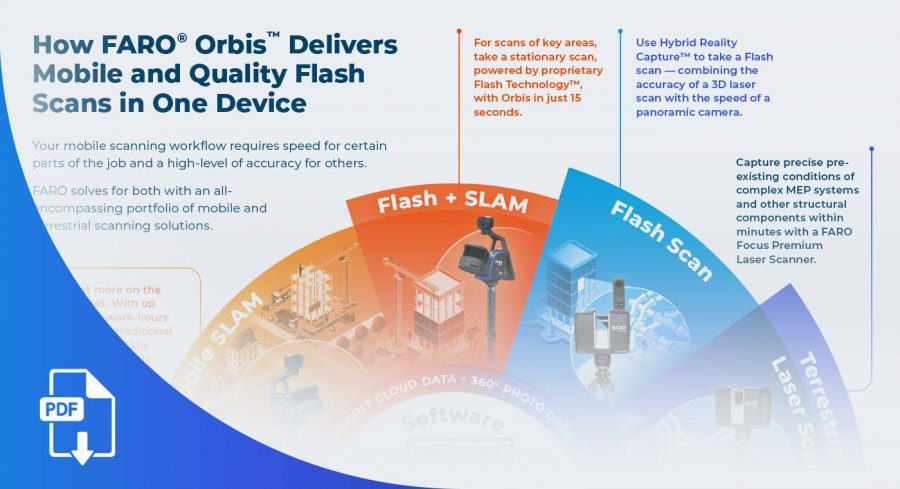
FARO® Orbis™ is a unique mobile scanning solution created to optimize workflows and elevate productivity. Designed for construction, engineering and surveying professionals, Orbis delivers rapid speed of capture, while returning highly accurate 3D visual representations of the real world. Integrating FARO’s Flash Technology™ in Orbis allows for stationary scans in just 15 seconds and provides unrivaled detail from a mobile mapping solution.
Powered by GeoSLAM’s proprietary SLAM algorithm, it’s the evolutionary step for industry professionals looking to provide highly accurate deliverables faster, reduce human error and magnify overall efficiency. Embrace the power of hybrid mobile scanning with stationary Flash scanning capabilities and embark on a new journey to transform your projects with Orbis – the ultimate companion for modern scanning challenges.

How FARO ® Orbis ™ Mobile Scanner, which delivers mobile scans alongside quality Flash scans, fits into a workflow with Hybrid Reality Capture ™, powered by Flash Technology ™, and the FARO® Focus Premium Laser Scanner.
Weighing just 3.6kg, including the datalogger and battery, Orbis is ideal for scanning large areas fast, without large setups.
A precision of 5mm during a mobile scan and 2mm during stationary Flash scanning makes Orbis the ultimate mobile scanning solution for high levels of accuracy.
With up to 120 meters in range, Orbis is the ideal solution for both indoor and outdoor scanning, with the ability to seamlessly transition between both.
Orbis offers local processing in the FARO Connect software or optional FARO Sphere® XG Digital Reality platform – flexible solutions for processing, analyzing and sharing data.
The integrated 8-megapixel camera on the Orbis enables colorized point clouds and additional 360° panoramic pictures.
Engineered with the toughest environments in mind, Orbis has the capacity to map places like underground mines, dense forests or construction sites with ease.
The Orbis is compatible with a monopod for stationary Flash scanning, car mount for capturing larger areas, backpack for tough terrain, and cradle for descending into a mine shaft, it is truly an all-in-one solution.
Points per second: 300,000
Number of Sensors: 16
Relative accuracy: up to 6mm
Range: 100 meters
Points per second: 300,000
Number of Sensors: 16
Relative accuracy: up to 6mm
Range: 100 meters


