Surveying Drone Products
![eBee X DRONE](https://cartocanada.ca/wp-content/uploads/2020/10/2018-05-10-Final-Model-eBee-X-1024x622-1.png)
eBee X
DRONE
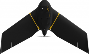
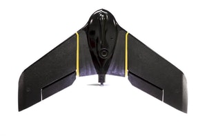
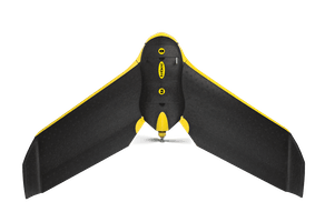
The eBee X is the fixed-wing drone for all your mapping needs. Designed to boost the quality, efficiency and safety of your data collection, it has a camera to suit every job, the accuracy and coverage to meet every project’s requirements, and can work virtually every type of site.
![eBee Plus](https://cartocanada.ca/wp-content/uploads/2020/10/eBee-Plus.jpg)
eBee Plus
DRONE
The eBee Plus survey drone is a large-coverage photogrammetric mapping system featuring RTK/PPK upgradeability, for survey-grade accuracy on demand.
![ebee Classic](https://cartocanada.ca/wp-content/uploads/2020/10/ebee-1024x702-1.png)
eBee Classic
DRONE
The AgEagle eBee Classic is a fully autonomous and easy-to-use mapping drone. Use it to capture high-resolution aerial photos you can transform into accurate orthomosaics (maps) & 3D models.