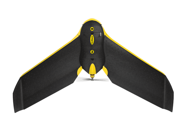
The EagleNXT eBee Classic is a fully autonomous and easy-to-use mapping drone. Use it to capture high-resolution aerial photos you can transform into accurate orthomosaics (maps) & 3D models.
The eBee Classic can cover up to 12 km2 (4.6 mi2) in a single automated mapping flight, while flights over smaller areas, at lower altitudes, can acquire images with a ground sampling distance of down to 1.5 cm (0.6 in) per pixel
EASY
The eBee Classic is the easiest to use mapping drone on the market—just throw it into the air. It then flies, captures images and lands itself. No piloting skills required!
SAFE
The eBee Classic weighs just 700 g (1.5 lb), vastly minimizing its kinetic energy. Plus, EagleNXT’s cutting-edge autopilot manages a wide range of intelligent failsafe behaviors.
FIND THE RIGHT SOLUTION
Contact one of our solutions specialists to explore the drones, sensors and software options that will work best for you.