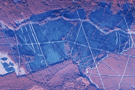
Drone Technology for
FORESTRY
Forestry
APPLICATIONS

Surveying
Accurate and detailed drone imagery allows for fast and efficient surveying of forests. Allowing for accurate decision making and assessment of forestry needs.

Inspecting and Monitoring
With the flexibility of launching a drone at any time, inspecting and monitoring an area is easier than ever. Data over time to ensures that any efforts are being as effective as possible.
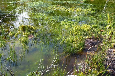
Conservation
Drone data enables a range of tasks to be performed, from health analysis and biomass estimation to inventory management, planting campaign planning, and impact assessments.
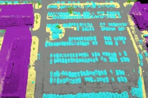
Drones can be launched on demand, for a variety of forestry efforts. Small and light electric-powered drones, especially fixed-wing aircraft, make little noise and are often bird-shaped, meaning animals on the ground are rarely disturbed by these tools, if they notice them at all. Rotary (helicopter) drone systems are best suited to monitoring and charting smaller areas, enabling operators to capture video imagery and respond to this feedback live, while fixed-wing drones—such as EagleNXT’s eBee—allow users to map larger areas in a single autonomous flight.
Related forestry
PRODUCTS
-
Pix4Dmapper
Read moreDefine an area of interest, select processing options, add ground control points or edit point clouds, DSMs, meshes, and orthomosaics.
FIND THE RIGHT SOLUTION
Contact one of our solutions specialists to explore the drones, sensors and software
options that will work best for you.


