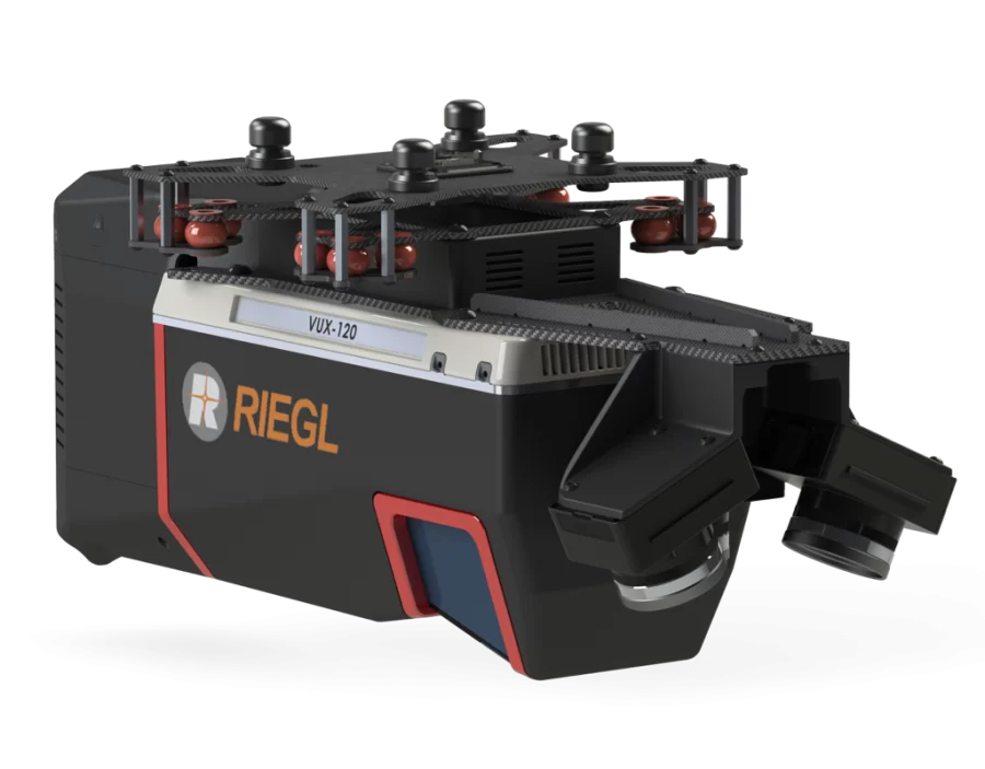
LiDar Scanner – RIEGL VUX-120
LIDAR Beams/Returns – Up to 5 per outgoing pulse
Pulse Repetition Rate – Up to 2.4 Mhz (selectable)*
Position and Orientation System (POS) – Applanix APX-20
Camera Sensor – Triple 1” sensor with mechanical shutter, hardware mid-exposure pulse, 60 MP combined, RGB.
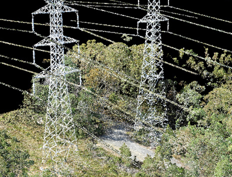
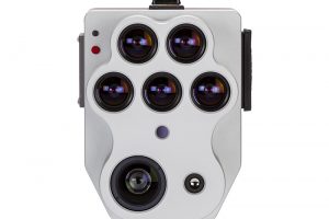
A New Class of System for New Challenges: TrueView 720 with 3 LiDAR + imagery sensors
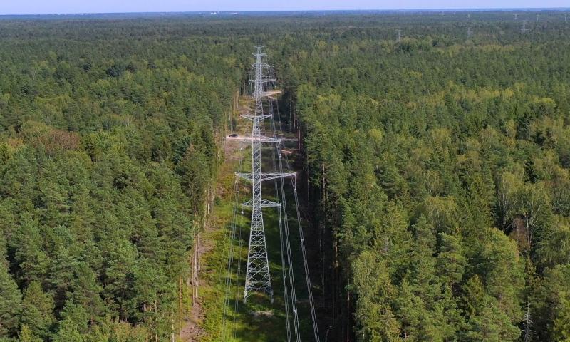
TrueView 720 is our fourth generation RIEGL integration. This is the system for high point density corridor mapping. Using the RIEGL VUX-120 with 3 lidar scanners (oriented nadir and +10 degrees forward and -10 degrees backward) and 3 oblique/nadir cameras for extremely detailed data collection in one flight path. When scanning power lines, users will be able to capture the poles vertically, front and back. The system can be integrated with drones, airplanes, or helicopters. Ask about custom camera configurations to cover your specific needs.
TrueView 720 with 3 LiDAR + imagery sensors
Specification
Value
Data Collection
LIDAR + Imagery
LIDAR Scanner
RIEGL VUX-120
LIDAR Beams/Returns
Up to 5 per outgoing pulse
LIDAR Range – usable
720 m for targets with > 20% reflectivity
Positioning and Orientation System
Applanix APX-20, ask for other IMU options available
Pulse Repetition Rate
Up to 2.4 Mhz (selectable)*
Accuracy
Typical: 1cm*
Precision
Typical: 0.5 cm*
Camera Sensor
Triple 1” sensor with mechanical shutter, hardware mid-exposure pulse, 60 MP combined, RGB. Ask for further custom camera integration.
2 days of free training at our Huntsville Headquarters
ADD-ONS
Looking for drone mapping equipment and accessories? GeoCue sells mounting kits, batteries, drones, base stations and spare parts partnered with our bundled solutions. Contact our sales team below to discuss all your equipment needs.
DRONES
MOUNTING KITS
BASE STATIONS
SPARE PARTS
INSURANCE
FINANCE
Integrations
TrueView Subscription
TrueView 535
TrueView 650/660
TrueView 720
LP360 Drone
✓
✓
✓
✓
LP360 Desktop Photo
✓
✓
✓
✓
LP360 Strip Align
✓
✓
✓
✓
3D Accuracy
✓
✓
✓
✓
LP360 Drone
Drone LiDAR and photo processing workflow made simple
Use LP360 Drone for
Intuitive workflow
Multi-flight import and processing
GIS interface allows combination with other geospatial data
Powerful point cloud visualization with multiple and synchronized windows
LP360 Desktop Photo
We have integrated directly into our drone mapping processing software, LP360 Drone, a Photo engine to produce fast backdrop orthophotos for your LiDAR project.
LP360 Photo is the LP360 Drone add-on for Ortho mapping:
Create your orthophoto backdrop in a completely integrated workflow
Efficient fast processing
LP360 Photo additional features:
Export photo package to your 3rd party Photogrammetry software
Support most common 3rd party sensors (DJI Mavic 3E, DJI Phantom 4 RTK and DJI Zenmuse P1)
LP360 Strip Align
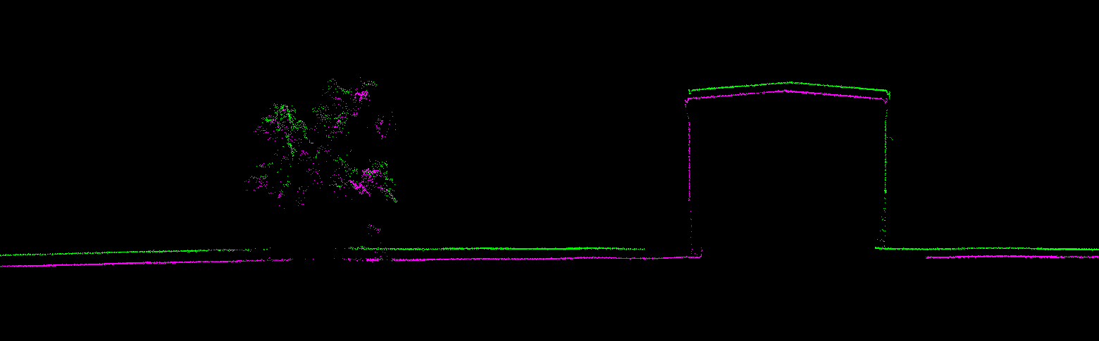
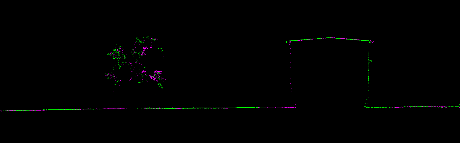
Data can exhibit small geometric inconsistencies, especially when combining data from multiple flights. Strip Align for LP360 Drone detects and corrects these errors via an application of sensor-specific mathematical modelling. Strip Align is a fully automated process with no need for users to set project-specific “tuning” parameters or to move in and out of the LP360 Drone processing environment – press a button and it works!
Image Exaggerated to Display StripAlign Effect
LP360 3D Accuracy
Automated horizontal and vertical checks remove the need for manual interaction
Use 3D Accuracy for:
Automatically transform your check point coordinates into you project coordinates including datum and epoch
“AutoTarget” – Automatically find a 3D target on a drone dataset
Calculation of correction for any 3D target
Seamless workflow to apply the correction on the point cloud
Our TrueView 3D Imaging Sensors were designed as a lightweight payload to allow flexible integrations on numerous drone platforms. We have worked with several drone providers to provide customers the complete drone mapping solution they are looking for. Don’t see the company you’re looking for, contact our team and we can discuss custom intergrations!