


Linear mapping made easy

Related products
-
-
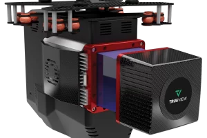
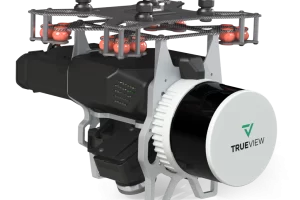
TrueView 720
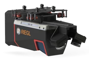
Read moreLiDar Scanner – RIEGL VUX-120
LIDAR Beams/Returns – Up to 5 per outgoing pulse
Pulse Repetition Rate – Up to 2.4 Mhz (selectable)*
Position and Orientation System (POS) – Applanix APX-20
Camera Sensor – Triple 1” sensor with mechanical shutter, hardware mid-exposure pulse, 60 MP combined, RGB. -
TrueView 655/660
Read moreLiDar Scanner – RIEGL miniVUX-3UAV
LIDAR Beams/Returns – Up to 5 per outgoing pulse
Pulse Repetition Rate – Up to 300 kHz (selectable)*
Position and Orientation System (POS) – (655) Applanix APX-15 | (660) Applanix APX-20
Camera Sensor – 3 Sony IMX-183: 1”, 20 MP, RGB -> 60 MP per payload -
Trueview 535
Read moreLiDar Scanner – Hesai M2X
LIDAR Beams/Returns – 32/2
Pulse Repetition Rate – 640 kHz
Triple Cameras – ‡120° cross-track FOV combined
Camera Sensor – Triple 1’’ mechanical shutter, hardware mid-exposure pulse, 60 MP combined, RGB