TrueView 435 – CartoCanada

TrueView 435

Laser Scanner – Hesai Pandar XT
LIDAR Beams/Returns – 6/2
Pulse Repetition Rate – 320 kHz
Position and Orientation System (POS) – Applanix APX-15
Camera Sensor – 1″ mechanical shutter hardware mid-exposure pulse 20 MP RGB

Categories ,

SHARE THIS PRODUCT ON:

TrueView 435 3D Imaging System


SpecificationValue
Data CollectionLIDAR + Imagery
Laser ScannerHesai Pandar XT
LIDAR Beams/Returns16/2
LIDAR Range80 m @ 20% reflectivity
Pulse Repetition Rate320 kHz
Cross-Track Field of View120°
Position and Orientation System (POS)Applanix APX-15
AccuracyBetter than 5 cm, RMSE
PrecisionBetter than 5 cm at 1 σ
Camera Sensor1’’ mechanical shutter, hardware mid-exposure pulse, 20 MP, RGB

TrueView 435 3D Imaging Sensor

Featured Applications

Before After
Before After
Before After

WHAT'S INCLUDED

HARDWARE

  • TrueView 435 3D Imaging Sensor

ACCESSORIES/PARTS 

  • TrueView Battery + Battery Charger
  • External Power Adaptor
  • USB
  • Control Box
  • GNSS Antenna 
  • Sensor Hardcase 

SOFTWARE

DATA MANAGEMENT

SUPPORT

  • 1 year of hardware and software support
  • 2 days of free training at our Huntsville Headquarters

ADD-ONS

DRONES

MOUNTING KITS

BASE STATIONS

SPARE PARTS

INSURANCE

FINANCE

RENTAL AVAILABLE

The TrueView 435 3D Imaging System is available under our subscription offering! This unique business model that allows customers to acquire a True View 3DIS under a subscription model for periods as short as 1 month! This is an excellent model for seasonal use and surge capacity. Our TrueView Rental Program works off a point system giving users the ability to control the usage of their subscription hardware and processing workflow.

Integrations

TrueView Subscription TrueView 435 TrueView 515 TrueView 655/660
LP360 Drone  ✓
LP360 Desktop Photo Optional Add-On
LP360 Strip Align

LP360 Desktop Photo

We have built interfaces directly into our drone mapping processing software, LP360 Drone, for driving both an embedded version of Metashape (Metashape for LP360 Drone) as well as the full GUI version of Metashape Professional. This design provides a seamless photogrammetric workflow for users of LP360 Drone processing software. Metashape for LP360 supports the generation of:
  • LP360 Desktop Photo imagery for improving positional accuracy
  • Point clouds from imagery (“structure from motion”) – typically used in DJI camera workflows
  • Orthomosaics

LP360 Strip Align

Data can exhibit small geometric inconsistence, especially when combining data from multiple flights. BayesMap StripAlign for LP360 Drone detects and corrects these errors via an application of sensor-specific mathematical modeling. StripAlign is a fully automated process with no need for users to set project-specific “tuning” parameters or to move in and out of the LP360 Drone processing environment – press a button and it works! Image Exaggerated to Display StripAlign Effect 
Before After

DRONE PLATFORMS

Our TrueView 3D Imaging Sensors were designed as a lightweight payload to allow flexible integrations on numerous drone platforms. We have worked with several drone providers to provide customers the complete drone mapping solution they are looking for. Don’t see the company you’re looking for, contact our team and we can discuss custom intergrations!

FREQUENTLY ASKED QUESTIONS

Have questions about the TrueView 435 system? Review our TrueView 435 FAQ.

Yes, the TrueView 435 is field upgradeable to a TrueView 515. This might be of interest to you if you are routinely collecting in dense vegetation and/or are entering the business of collecting distribution level power lines. Discuss pricing with us or your system reseller.
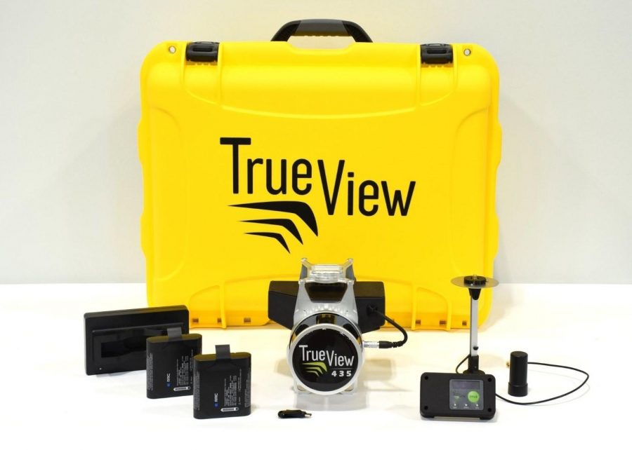
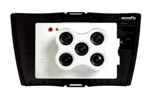
The minimum requirement base station must include
  • Static observations recorded to some media
  • Dual frequency L1/L2
  • Ability to transform the observation file to RINEX format, version 2.11 or later
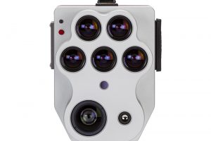
TrueView 435 positioning is always determined using a post-processing workflow. For this reason, the base station does not need to be equipped with a radio. Nearly any high-quality base component of a survey-grade RTK kit will work just fine. For information regarding a specific base station, please contact us.

There are too many variables to give a firm answer. Calibration is affected by how often you fly, how much shock the sensor has been subjected to and so forth. We provide procedures within TrueView EVO (the included post-processing software) that will provide indications of the need for a new calibration.