


Shop
Showing 1–12 of 125 results
-
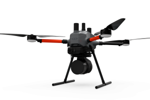
EasyOneLiDARUHR+
$0.00 Add to cartThis is our best LiDAR drone surveying equipment ever. Built upon our 4th-gen drone technology, all EasyOne systems are more compact, more optimized, lighter, safer and more efficient. This system delivers integration unmatched in the drone surveying industry, making it easier than ever for you to plan, fly, collect, process and visualize your geospatial data projects.
-
LP360 Drone
Read moreProcess, analyze, and maximize drone survey data, producing valuable information and deliverables
-
Pix4Dmapper
Read moreDefine an area of interest, select processing options, add ground control points or edit point clouds, DSMs, meshes, and orthomosaics.
-
LP 360 Geospatial
Read moreQuality control LiDAR data, extract information, and derive products from large datasets
-
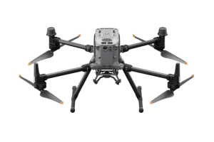
Matrice 300 RTK
$8,950.00 Add to cart15 km Max Transmission
55-min Max Flight Time
IP45 Rating
Smart Inspection
Smart Pin & Track
Primary Flight Display -
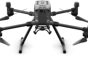
Matrice 350 RTK
$10,939.00 Add to cart20 km DJI O3 Enterprise Transmission
55-min Max Flight Time
IP55 Rating
6-Directional Sensing & Positioning
DJI RC Plus
Primary Flight Display
Night-Vision FPV Camera -
-
-
-
-
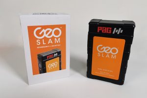
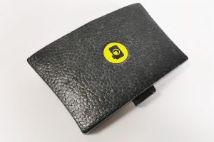
GeoSlam Battery
Read moreThe battery has been tested and passed section 38.3 of the UN Manual of Tests and Criteria (UN Transportation Testing) and
is approved for air shipment. -
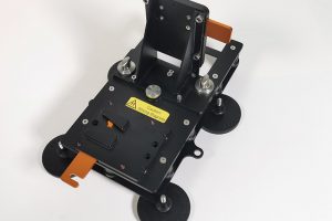
GeoSlam Car Mount
Read moreUsing the ZEB car mount, the ZEB Horizon can be securely mounted to a vehicle to collect data up to 30mph/48kmph.